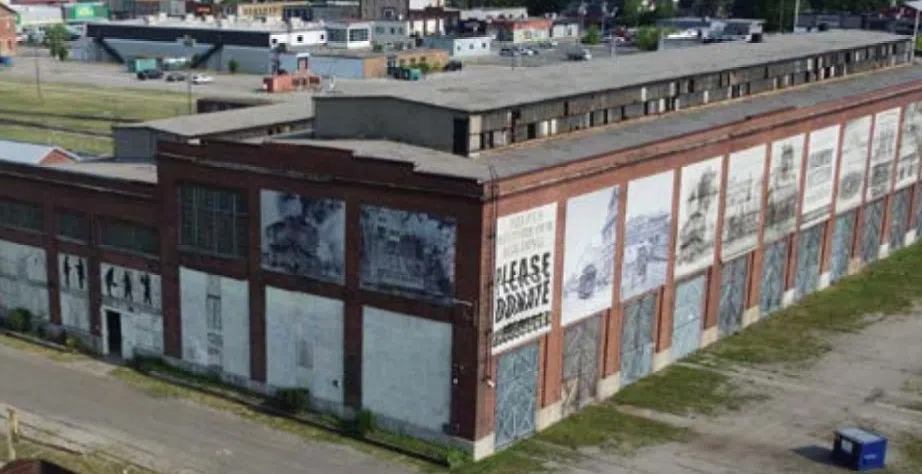
The city has unveiled the Preferred Master Plan for the railway lands downtown.
The plan identifies areas for development and redevelopment, permitted land uses, transportation and mobility connections, parks, public service/community uses, and infrastructure strategies.
All of this while recognizing the historical significance of the railway lands and the Downtown St. Thomas Heritage Conservation District to ensure an appropriate transition of new development to low-rise residential areas.
In part, this follows the recent sale of a parcel of land at the Elgin County Railway Museum to Doug Tarry Homes for a planned residential development.
Brandon Sloan, the city’s Housing Accelerator Fund Coordinator, presented the Railway Lands Area Master Plan – Phases 1 and 2 to city council earlier this month.
The plan outlines three options, which are summarized with graphics.
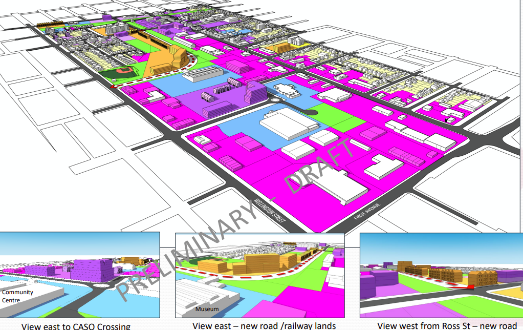
Concept 1 – Status Quo with Moderate Intensification Scenario
Potential for 475 to 1,325 new housing units – growth of 800 – 2,300 population
Highlights:
1. New Centre St. road extension connecting south to Wellington St. as a public street with access to adjacent lands (red dash line on graphic)
2. Continue with primarily commercial land use on Talbot St./First Ave./Wellington St.
3. Integrate new medium-rise residential (shown in orange) and medium-rise mixed-use (dark purple) for vacant and some redevelopment parcels
4. Allow for low-rise mixed-use on portions of Ross St. and Princess Ave./Centre St., with the remainder of the area mostly as existing land use permissions
5. New central park space, green corridor along Centre St. extension, rectangular Jonas Park, small addition to skate park area
6. Active transportation corridor east-west through lands (public ownership & easements) with one connection from/to Talbot St.
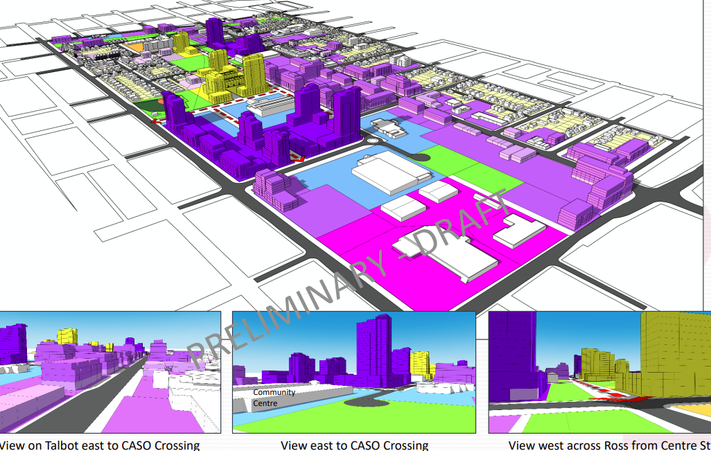
Concept 2 – High Mixed Use and Connectivity Scenario
Highlights:
1. New Centre St. road extension connecting east to CASO Crossing as a public street (red dash line on the graphic)
2. Create new public streets in grid pattern in central portion of area connecting to existing streets and providing access to new development blocks
3. Allow for mixed use along all of Talbot St, more portions of Wellington St, Princess Ave, Moore St.
4. Capitalize on vacant, larger parcels with high-rise mixed-use (nine storeys or greater, dark purple on graphic) or residential (yellow on graphic, nine stories or greater) for new housing or range of uses and to support surrounding businesses
5. Revised Jonas Park as central park square, green space in front of CASO building, larger addition to skate park area, new public square (Ross/Talbot)
6. Active transportation corridor east-west through lands (public ownership & easements) with one connection from/to Talbot St. (+ road connection)
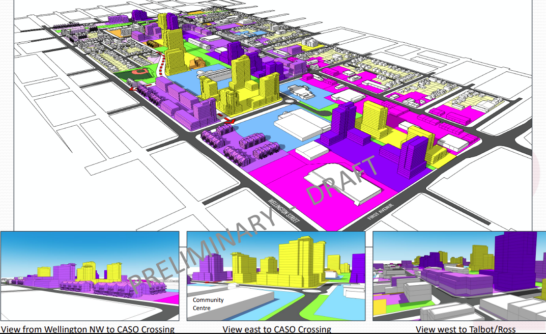
Concept 3 – Hybrid Intensification Scenario
Potential for 2,500 to 3,500 new housing units – growth of 4,200- 5,700 population
 Highlights:
1. No Centre St road extension; a new public street from CASO Crossing to widened Jonas St and connecting to Wellington St. (red dash line on graphic)
2. Allow for mixed use along all of Talbot St., mostly to Balaclava St./CASO Crossing, on Wellington St., Princess Ave, Moore St., Ross St.
3. Utilize vacant, larger parcels with high-rise residential/mixed-use or medium-rise residential/mixed-use for new housing opportunities
4. Maintain commercial land use on Talbot East area, Wellington/First; allow mixed use for flexibility on portion of First Ave. lands
5. New linear park system with open area/views/connections to CASO Station and museum
6. Active transportation corridor east-west through lands as full public ownership open space system and multiple connections from/to Talbot St./Jonas St.
Remember, these are conceptual plans for information purposes only; however, if you live in the Jonas St. area, or east of First Ave., your view in the coming decades could potentially be a forest of high-rise buildings.
The full plan can be accessed here.